We utilize data from these and other trusted government sources:
Tap into our robust data insights you won’t find anywhere else, curated by the expertise of our PhD-led data science team. This integration of diverse, reliable data ensures our insights are both comprehensive and actionable, providing you with unparalleled depth and accuracy for your strategic decisions.
Our data science team has worked with federal data sets for decades. With this knowledge we have been able to combine variables from multiple sources and create modeled variables and indexes that simplify your targeting and offer comparative insights between communities. These include but are not limited to our proprietary “Total Wealth Index” , “Economic Activity Index” which amounts to a community level GDP, and “America Dream Index” of housing affordability, and more.


If you are looking to understand the diversity of the country, EMMA gives you one-of-a kind tools that you will not find elsewhere, even the U.S. Census Bureau.

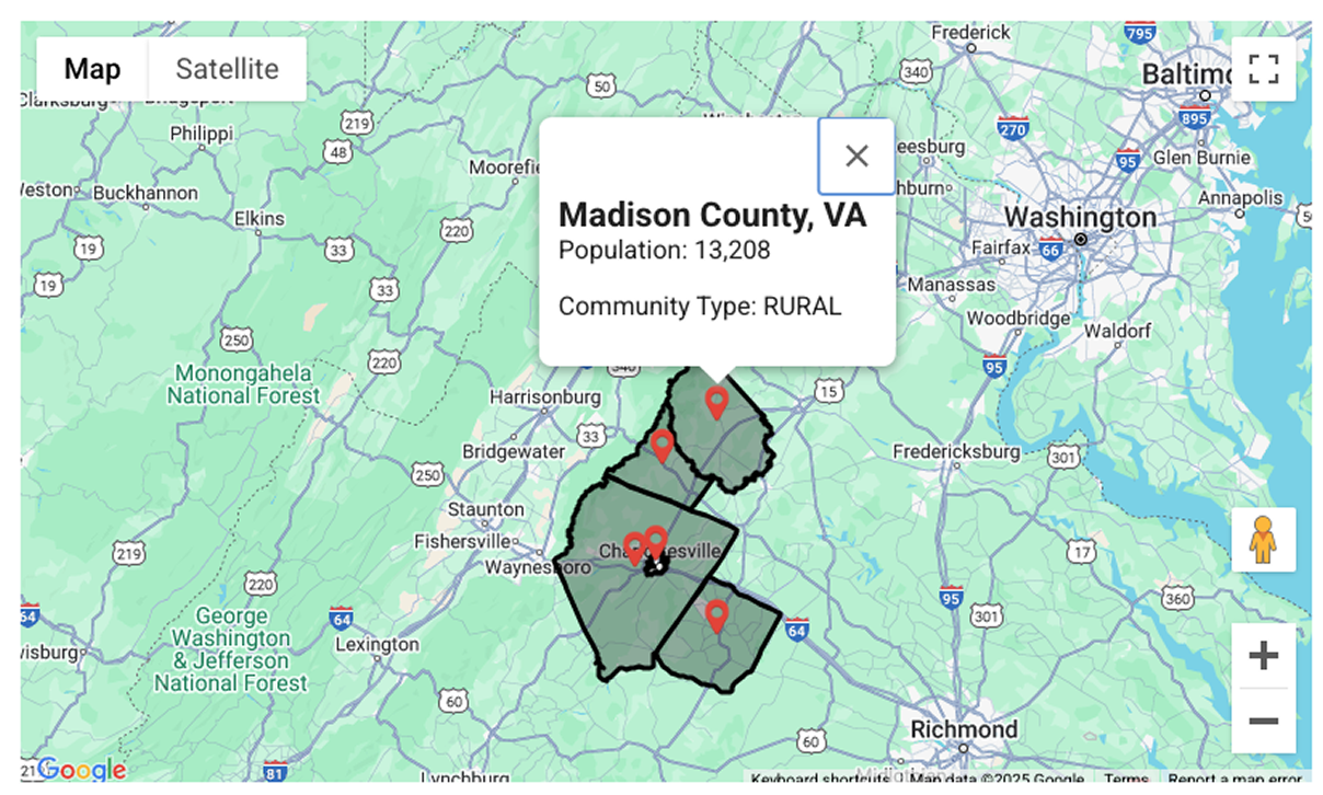
To create the Urban/Rural/Mixed county designation within EMMA, we took advantage of Census Bureau designations of small geographies called, "Blocks". Blocks add up to counties, but the Census Bureau does not declare whole counties urban or rural. Many counties include a mix of urban and rural areas – even highly urban counties can still include rural areas. The EMMA data science team has bridged this gap by looking at every county and classifying them for you as “Urban”, “Mixed” or “Rural”.
The vast majority of land in the USA is in rural areas (97.1%), while the vast majority of the population is in urban areas (80.0%). These majorities tend to skew any attempt at taking simple averages within counties. Moreover, counties in different parts of the country developed very differently due to historical and political factors. For example, eastern counties tend to include smaller land areas, which western areas – even those with a major urban center – often include significant unpopulated land area.
America: Urban, Rural, Mixed
| Total Population | 331,449,281 | 100% |
| Total Urban Population | 265,148,664 | 80% |
| Total Rural Population | 66,300,617 | 20% |
| Total Land Area (sq miles) | 3,533,018 | 100% |
| Total Urban Land Area | 103,872 | 2.9% |
| Total Rural Land Area | 3,429,147 | 97.1% |
EMMA County Classifications Summary
| Urban County Total Pop | 182,383,821 | 100.0% |
| Urban County Urban Pop | 176,048,307 | 96.5% |
| Urban County Rural Pop | 6,335,514 | 3.5% |
| Rural County Total Pop | 40,347,227 | 100.0% |
| Rural County Urban Pop | 11,635,236 | 28.8% |
| Rural County Rural Pop | 28,711,991 | 71.2% |
| Mixed County Total Pop | 108,718,233 | 100.0% |
| Mixed County Urban Pop | 77,465,121 | 71.3% |
| Mixed County Rural Pop | 31,253,112 | 28.7% |
The EMMA data science team curates the millions of variable inputs from official statistics to surface insights and understand these massive databases, empowering you to find the information you need quickly.
The EMMA data tool played a crucial role in refining and structuring data sets that served as the foundation for Altumint’s Florida Road Safety Report.

EMMA was successful in delivering incremental reach to our campaign’s core target audience utilizing hyperlocal targeting.